Skip to content

This weekend: CRSSD Fall · Sat Doors noon both days · Tickets on sale

The San Diego List*
WEEKEND
Things to Do · Itineraries

Point Loma, Ocean Beach & Liberty Station in One Day

An 1855 lighthouse, lunch beside the fishing boats, a Navy base turned arts district and a Sunset Cliffs finish: Point Loma and Ocean Beach in one day.

10 stopsCopy updated Sep 23, 2026Sources checked Aug 2, 2026By The San Diego List

The short answer

To see Point Loma, Ocean Beach and Liberty Station in one day, start at Cabrillo National Monument when the gate opens at 9 AM, because its trails and coastal areas close first.

See the harbor-and-Pacific overlook and the 1855 lighthouse, walk Shelter Island, and eat lunch by the fishing boats at Point Loma Seafoods or Mitch's Seafood. Then walk Liberty Station's NTC promenade in the Midway District, Dog Beach and Newport Avenue in Ocean Beach, and end at a Sunset Cliffs viewpoint before dark.

NeighborhoodsPoint Loma →Midway District & Liberty Station →Ocean Beach →

Point Loma is a peninsula with the bay on one side and the open Pacific on the other, and it holds a lot of San Diego. At its tip, a monument marks Juan Rodriguez Cabrillo's arrival in San Diego Bay in 1542, and a lighthouse from 1855 stands on the high ground. On the harbor side, fishing boats sit beside the lunch counters. At Liberty Station, a Navy training center has become an arts district. On the ocean side, Ocean Beach runs down to the sand while the bluffs at Sunset Cliffs face the horizon.

This Point Loma, Ocean Beach and Liberty Station one-day itinerary strings all of it together in ten stops, in route order: the Cabrillo overlook and lighthouse, an optional tidepool detour, a shoreline walk on Shelter Island, a harbor lunch, the old Naval Training Center and its food market, Dog Beach, Newport Avenue, a look at the closed Ocean Beach Pier from the sand, and a sunset from an established viewpoint at Sunset Cliffs.

A few things make the day work. Be at Cabrillo for the 9 AM opening, since the monument's trails and coastal areas close before its 5 PM gate and the rest of the route can bend around a late lunch. Plan on a car, because the stops run from the tip of the peninsula to the mouth of the San Diego River and don't link up as one continuous walk. And check the day's conditions before you leave: the tide, Ocean Beach water quality, your lunch counter's hours and the sunset time. Any of them can shift a stop.

When the sun is down and everyone's hungry again, our Ocean Beach restaurant ranking picks up where this day ends, the best views in San Diego rounds up more of the city's viewpoints, and San Diego without a car is the better plan if you're traveling without one.

Before you go

Five checks before you lock in the day

The night before, or the morning of, check five things for your date: Cabrillo's hours and whether its coastal area is open, the tide, the County's water-quality status for Dog Beach and Ocean Beach, the hours at the harbor lunch counter you've picked, and the time of sunset. Any one of them can move a stop around. Knowing them before you leave keeps the day relaxed.

Cabrillo visitor center and lighthouse core

MORNING · ROUTE BLOCK
The move
Be at the gate when it opens at 9 AM, and walk the visitor-center overlook before the lighthouse.

The day starts at the tip of Point Loma, with the oldest story on the route. In 1542, Juan Rodriguez Cabrillo sailed into San Diego Bay, the first European to land on the California coast, and Cabrillo National Monument commemorates that arrival. It also keeps the lighthouse that marked this peninsula for passing ships. Of the ten stops in this itinerary, this is the one to get right, because it runs on the tightest schedule of the day.

Head to the visitor-center overlook first. The whole day lays itself out in that one view: the bay and the working harbor on one side of Point Loma, the open Pacific on the other. Lunch is waiting on the harbor side. The sunset is waiting on the ocean side. There's no clearer way to understand the peninsula before you spend the rest of the day driving it.

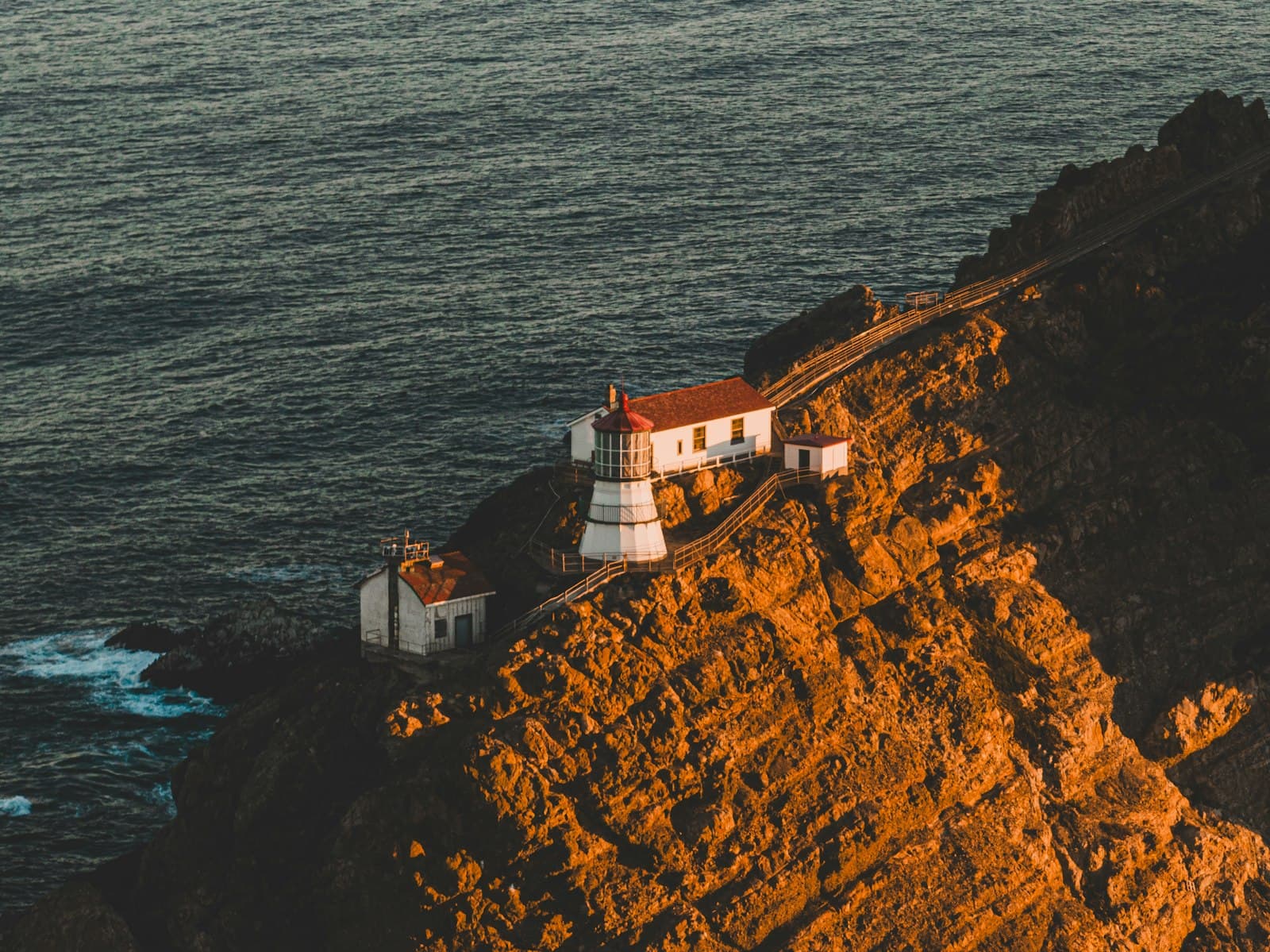
Then make your way to the Old Point Loma Lighthouse. It went up in 1855 and stands 422 feet above sea level at the peninsula's tip. Between the lighthouse and the Cabrillo landing, the monument covers two very different chapters of San Diego's past, three centuries apart, in a single morning. Give both of them real time. This is the part of the route you can't easily circle back to later.

Here's how the clock works. Be at the gate for the 9 AM opening. The main gate closes at 5 PM, but the interior trails and coastal areas close before that, so Cabrillo can't slide into the afternoon the way the other stops can. It's also a long drive out to the tip, and there's a vehicle entrance fee to plan for. Everything after lunch, from Liberty Station to Sunset Cliffs, has room to stretch if the morning runs long. Protect the morning and the afternoon can bend.

Cabrillo coastal and tidepool-area extension

MORNING · ROUTE BLOCK
The move
Check the tide and the park's coastal-area status before you commit to the coastal road.

Cabrillo has a second side, down by the water. The coastal road leads from the high overlook toward the cliffs and the tidepool area, where a low tide reveals sea stars, anemones and the rest of the intertidal crowd. The cliffs above hold native coastal sage scrub and rare plants. When the tide and the park cooperate, it turns the Cabrillo morning into two very different views of the same point of land.

That "when" is the whole planning question. Tidepool viewing depends on a low-tide window, and the useful low tides often fall outside the park's 9 AM to 5 PM hours. Access to the coastal road is seasonal and depends on the weather, and the park can close the coastal area for surf, wind, weather or marine mammal activity while the lighthouse stays open.

So this stop is optional by design. Check the tide and the park's coastal-area status before you leave home, then check again once you're at the monument. If the tide is low and the road is open, add it. If either one says no, spend that time back at the overlook and the lighthouse, the part of Cabrillo that's always there, and save the tidepools for a morning with a friendlier tide.

There's a second chance later in the day. The Ocean Beach shelf has tidepools too, but it only works when a low tide falls in daylight and conditions are safe. Wherever you end up looking, leave the sea stars and anemones where you found them.

Shelter Island shoreline reset

MIDDAY · ROUTE BLOCK
The move
Walk a stretch of the shoreline instead of circling the island by car.

Shelter Island is made land. It's a peninsula created from fill, and it took its present shape in the 1950s. On this route it's the breather between the monument and lunch. After the long drive back from Cabrillo, park once, get out of the car and walk a stretch of the shoreline.

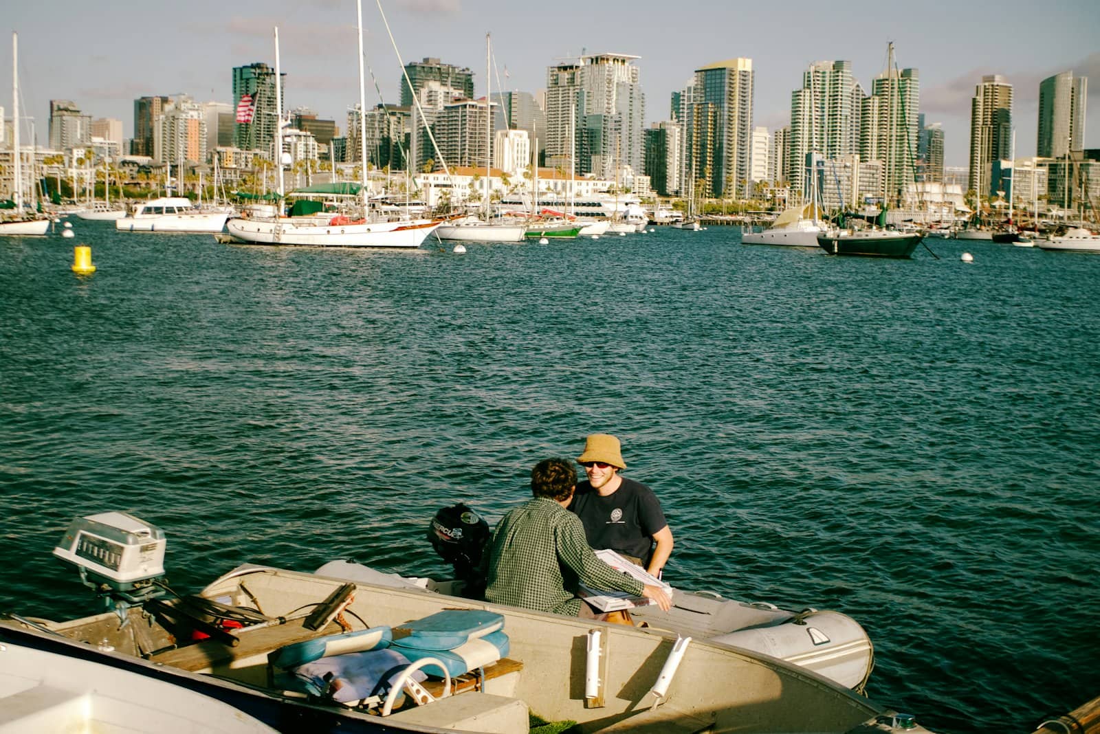
The view does the work. Across the bay, the downtown San Diego skyline lines up along the water. Turn the other way and you're looking at the working harbor and its fishing boats, the next stop on the route. That one walk ties the morning to the afternoon: the history out at the tip, the city across the water, and lunch waiting on the harbor.

Keep it simple. There's no ticket, no reservation and no reason to finish a loop. Walk as far as the group feels like walking, turn around when someone starts talking about fish, and head to lunch. Driving a lap of the island is tempting, and it's the walking that makes this stop worth it.

Public access to the shoreline follows the City's current park notices, and maintenance or closures can change which stretches are open on a given day. If your schedule is tight, check the notices first. The stop only needs one open stretch to do its job, so a closed section just means a different starting point.

Your next good San Diego plan.
Places to try, weekend ideas and the local updates that change your plans. Join the early list. We’ll email you when the first issue launches.
By subscribing, you agree to receive The Shortlist by email when it launches. Free; unsubscribe anytime. See our privacy policy. Questions about The Shortlist?

Lunch on the working harbor

MIDDAY · ROUTE BLOCK
The move
Pick Point Loma Seafoods or Mitch's Seafood before leaving Cabrillo, check its hours, then head straight there.

Point Loma is a major commercial fishing port, and lunch on this route happens right on the working waterfront. Two seafood counters sit on the fishing-boat basin: Point Loma Seafoods at 2805 Emerson Street and Mitch's Seafood at 1403 Scott Street. At both, the working boats are right beside you, and the harbor's day carries on in the background while you eat.

That setting is what people love about this stop, along with a menu built around fresh catch. Both are casual, counter-service places. Order at the counter, eat with the boats in view, and let the harbor set the mood.

The one rule here is to decide before you leave Cabrillo. The two counters keep separate hours, so check the one you want, put its exact address into the map and drive straight there. Keep the other in your back pocket. Lines and crowds shift through the day, and a long wait at your first choice is a perfectly good reason to switch. Point Loma Seafoods also takes orders online, handy on a day with a schedule to keep.

If both counters are closed, or the lines are longer than your afternoon can afford, Liberty Public Market is the backup, two stops further along this route. Its independent vendors can feed a whole group without anyone having to agree on anything.

Liberty Station arts and promenade loop

MIDDAY · ROUTE BLOCK
The move
Start from the NTC promenade and give the old naval buildings as much attention as the art.

Liberty Station was a Navy base before it was an arts district. The Naval Training Center, known as NTC, was decommissioned in 1997, and beginning in the 2000s its historic buildings were restored and filled with galleries, studios, courtyards and public art. The NTC promenade runs through those restored buildings, and walking it is the heart of this stop in the Midway District.

Give the buildings as much attention as the art. The architecture is the constant here: the historic naval buildings themselves, old parade grounds turned into open space, and new courtyards set between them. The praise for Liberty Station centers on exactly that, the quality of the buildings and the public spaces, and the fact that the outdoor walk is always there for you.

The galleries and studios are the variable. Each keeps its own schedule, and many close early in the week. If there's one gallery you have your heart set on, check its hours ahead of time and treat every other open door as a bonus. If the one you wanted is closed, walk the promenade and the public courtyards as the main event. The outdoor loop works in any weather and on any gallery calendar.

The district is free to walk, with no entrance fee, and it stays open for strolling even when individual studios are closed. Parking is shared with Liberty Public Market, so one parking spot covers this stop and the next.

Liberty Public Market

MIDDAY · ROUTE BLOCK
The move
Pick your vendor from the market's current directory before you walk through the door.

Liberty Public Market is a collective of independent food vendors inside a restored naval building at Liberty Station, each running its own counter with its own menu and hours. On this route, it's the flexible stop. It can be a snack, a second lunch, or the whole lunch if the harbor counters didn't work out.

It's especially useful for groups. When one person wants seafood and another wants anything but, a hall full of separate vendors settles it. Everyone orders from a different counter and nobody has to compromise. Fans of the market point to that mix of local vendors as the reason to come.

The lineup changes often. Vendors turn over, so pick yours from the market's current directory before you walk in, and you'll spend your time eating instead of wandering. Crowds peak at lunch and dinner, so the stretch between the two is the easiest time to get in and out.

Parking is shared with the Liberty Station arts district, so the car stays put. If lunch already covered everyone, keep this one short, grab something small for the road and head for the beach.

Ocean Beach Dog Beach walk

AFTERNOON · ROUTE BLOCK
The move
Walk the designated shoreline and let the dogs supply the afternoon energy.

Dog Beach sits at the mouth of the San Diego River, where the river meets the Pacific in Ocean Beach. The City of San Diego designates it as a leash-free dog exercise area, so within the posted boundaries, dogs move freely. After a morning of lighthouses and an afternoon of galleries, this is the stop with the most energy on the route, and the dogs supply all of it.

You don't need a dog to come. The beach welcomes people without one, and watching other people's dogs have the best afternoon of their week is a fine way to spend part of yours. Open sand, a natural shoreline and a lot of happy dogs are the whole appeal.

A few ground rules keep it easy. Stay inside the posted City boundaries and follow the current City dog rules. Before anyone goes in the water, person or dog, check the County's beach-status page for water-quality advisories, closures or hazards. And since off-leash dogs are the point here, make sure everyone in your group is comfortable around them before you park.

If your crew would rather keep the afternoon calm, this is an easy stop to keep short. Newport Avenue is next.

Ocean Beach Newport Avenue and public-beach loop

AFTERNOON · ROUTE BLOCK
The move
Walk Newport Avenue down to the public beach and back, and leave the pier out of the plan.

Newport Avenue is Ocean Beach's main street. It runs perpendicular to the water, and a few blocks of shops, casual restaurants, coffee and street life lead right down to the public beach. Ocean Beach is a laid-back neighborhood beach, and Newport is where you feel that most. This part of the day happens on foot.

There's no need to plan every block. Walk toward the water, stop wherever something catches the group's eye, and use the public beach at the end as your turnaround. When everyone's had their fill, walk back. Its short, walkable length is a big part of the appeal, and the loop works whether you make it long or short.

Leave the pier out of the walking plan. The Ocean Beach Pier is closed, and the next stop covers how to enjoy it from the sand. The street and the beach are the walk.

Summer is when planning matters most. Parking fills quickly, and crowds and street events can temporarily close blocks of Newport Avenue. The Ocean Beach district and the City post notices for events, closures and parking impacts, so check them before you settle on a lot or a street.

Ocean Beach Pier, from the sand

AFTERNOON · ROUTE BLOCK
The move
Take in the pier from the public sand or the Newport Avenue street end. Walking out isn't possible.

The Ocean Beach Pier is the landmark you see from the foot of Newport Avenue, and it deserves a look. The existing pier is permanently closed to public access, though, so this stop is all about the view from the sand.

The City is working on a replacement. As of September 2026, that project is moving through permitting and environmental review, so for now the pier belongs in the view, not in the itinerary. For the latest on the replacement, the City's project page is the place to check.

You can see it from the public beach, or from the street end where Newport Avenue reaches the water. Either one gives you the pier as a landmark to close out the walk down the avenue. Take it in, then turn back toward the open parts of Ocean Beach.

One small kindness for your group: mention the closure before you reach the water. That way it's a bit of context on the walk down Newport, and nobody reaches the sand expecting to walk out on it. Then it's back to the car, because the last stop of the day is waiting on the ocean side of the peninsula, and it runs on sunlight.

Sunset Cliffs legal blufftop finish

FINISH · ROUTE BLOCK
The move
Arrive with real daylight left and watch the sunset from an established public viewpoint.

The day ends at the western edge of the peninsula. Sunset Cliffs looks out at the Pacific from above the bluffs, and the City maintains established public viewpoints along the top with clear sight lines to the horizon. People who plan a day around this spot point to two things: a dependable west-facing sunset, and the satisfying geography of finishing on the open ocean after a day spent crossing Point Loma.

Treat the edge with respect. These coastal bluffs are geologically unstable, and the City and County both describe them as treacherous and subject to erosion. Stay well back from the edge, and stick to the established viewpoints and marked paths. The informal paths down are unsafe, so leave them alone.

Timing is the other half of a good finish. Arrive while there's real daylight left, well before dusk, so you have time to park and settle in at your viewpoint. Parking fills early, especially in summer and before holiday sunsets. Watch the sun go down over the Pacific, then start back while the route is still easy to follow in the remaining light. If conditions change your plans, our guide to the best views in San Diego has other viewpoints around the city.

The day started with the Pacific seen from the tip of Point Loma. It ends with the same ocean from the peninsula's western edge.

Where they are

Places · Linked to the guide
Boundary map · every pin links to its entry
Focus spotsHover, focus, or tap

How we built this itinerary

This is a route, so the order follows the day: what opens first, what closes first and the drive between stops. Each stop earned its place mostly on the experience itself, which carries half the weight, with the rest split among what makes it unique, how reliably you can get in, how well it fits a day like this, safety and logistics, and its local significance. A spot on this list can never be bought, and access, hours and safety guidance were last checked in August 2026.

✓Route feasibility, official access, closing times, food stops, current pier status, coastal conditions, and bluff-safety guidance were rechecked against saved first-party sources August 1–2, 2026

Common questions

What is the best way to spend one day in Point Loma, Ocean Beach and Liberty Station?

Start at Cabrillo National Monument when the gate opens at 9 AM, since its trails and coastal areas close first. From there, walk Shelter Island, eat lunch at Point Loma Seafoods or Mitch's Seafood by the fishing boats, walk Liberty Station's NTC promenade and Liberty Public Market, then head to Dog Beach and Newport Avenue in Ocean Beach. Finish at an established Sunset Cliffs viewpoint with daylight to spare.

Do I need a car for this Point Loma day trip?

Cabrillo National Monument sits at the tip of Point Loma, and the route runs from there through Liberty Station and Ocean Beach, so yes, plan on a car. The stops are too spread out to walk as one continuous route. If you're going car-free, our San Diego without a car guide has a plan built for that.

What time does Cabrillo National Monument open?

Cabrillo National Monument's main gate opens at 9 AM and closes at 5 PM, and the interior trails and coastal areas close earlier than the gate. That's why this itinerary starts there: it has the tightest schedule of any stop. Check park hours for your date before you go, and plan on a vehicle entrance fee.

Can you walk on the Ocean Beach Pier?

The Ocean Beach Pier is permanently closed to public access, so plan to see it from the sand. As of September 2026, the City is moving a replacement through permitting and environmental review. You can still see the pier from the public beach or from the street end of Newport Avenue.

Where can you see tidepools near Point Loma?

Cabrillo National Monument has a tidepool area along its coast, where a low tide reveals sea stars, anemones and other intertidal life. Useful low tides often fall outside park hours, and the coastal road can close for surf, weather or marine mammal activity, so check the tide and park status first. The Ocean Beach shelf is another option, but only during a daylight low tide in safe conditions.

Is Dog Beach in Ocean Beach off-leash?

Dog Beach in Ocean Beach is the City of San Diego's designated leash-free dog exercise area, at the mouth of the San Diego River. Dogs can run off leash within the posted boundaries, and you're welcome without a dog, too. Follow current City dog rules, and check the County's beach-status page before any person or dog goes in the water.

Where can I watch the sunset near Ocean Beach?

Sunset Cliffs, at the western edge of the Point Loma peninsula, is where this route ends. The City maintains established public viewpoints above the bluffs with clear sight lines to the Pacific horizon. Arrive with real daylight left, stay well back from the unstable edge, and use only established viewpoints and marked paths. Parking fills early, especially in summer.

Where should I eat lunch in Point Loma?

Point Loma Seafoods on Emerson Street and Mitch's Seafood on Scott Street are the two harbor counters on this route, both right beside the working fishing boats. They keep separate hours, so check your pick before leaving Cabrillo. Liberty Public Market at Liberty Station is the flexible backup, with independent vendors for a group that wants different things.

Sources and verificationOfficial planning sources and dated primary evidence used to verify this guide.

About the author

The San Diego List blue asterisk editorial mark
By

Independent San Diego guide publisher

The publication byline for The San Diego List, published by Ezra Gonzalez. Independent guides use dated source research, clearly identified reporting and a public corrections process.

Keep planning

Read this next

San Diego's harbor and skyline viewed from the waterUp next · ItinerariesThe Perfect 5-Day San Diego ItineraryFive days by area: sea lions at La Jolla Cove, Old Town's adobes, Cabrillo's lighthouse, Chicano Park's murals, the Coronado ferry and a COASTER day.14 stops · Updated Aug 2 Keep reading →

More like this